Browsed by
Category: 2013

Hike #6234 – TASSEL HILL – December 28, 2013

Hike #6234 – TASSEL HILL – December 28, 2013

Write-up by Meg Higgerson

During the week prior to the scheduled hike, Meg and assistant Barb Thomas drove south to locate the Whaupaunaucau trail head and explore the trail.    The weather and thus the roads were terrible!!  In spite of our 4WD vehicle we decided it was in our best interest to abandon our exploratory adventure.

When 10 Tramps met in Sangerfield we decided, based on the local conditions and not knowing the actual location of the original trailhead, to hike Tassle Hill.   We had a good climb up the seasonal road and then we “bushwhacked” through the woods often following deer tracks.  All in all we hiked 5 miles and had as usual had a great time.


Hike #6228 – TENANT FALLS – December 7, 2013

Hike #6228 – TENANT FALLS – December 7, 2013

Write-up by Nancy Coleman

As far as I know this is the first time the Tramps have done this hike.  It starts from the same trailhead as Wilcox Lake.  It was a cold day and we started out because people were getting cold standing around.

After signing in we hiked about .2 miles to the right hand turn.  It was such a short distance; I didn’t stop to see if everyone was with us, a big mistake.  Eight of the nineteen hikers had fallen behind and didn’t make the turn.  They caught up with us at lunch.  I learned that the rule, “Always wait when there is a choice of paths.”, is very important.

The hike starts out following Stoney Creek.  The right hand turn is where Tenant Creek empties into Stoney.  We don’t go over the bridge.  We must cross over private property.

It was quite icy that day.  Everyone was warned to wear Micro-Spikes or Yak Traks and everyone was prepared.  With them, it was a wonderful hike.  Without them it would have been dangerous and horrific.

About a mile after the turn we get to our first waterfall.  There is a beautiful pool below the falls that would be wonderful for a swim on a hot summer day.  We continued always following the picturesque creek to Tenant Falls.  Here there are 3 falls with a swimming pool beneath each.  This is where we ate lunch and regrouped.

From the third falls we took a sharp right bushwhacking up a steep hill.  At the top of the hill is the jeep road.  We turn right on that and continue for about 2 miles to the dirt road.  It is a 1.5 mile hike along the dirt road which follows Stoney Creek to the trail head.

We saw hunters, so it is important to wear blaze orange in hunting season.

Everyone on the hike agreed we need to return on a hot day.
 

Hike #6225 – MYSTERY HIKE – November 24, 2013

Hike #6225 – MYSTERY HIKE – November 24, 2013

Write-up by Meg Higgerson

Twenty-three bundled Tramps braved the 8 degree weather to learn that the destination of the Mystery Hike was Bochen Lake and Hurrell Vly.  In spite of the cold, the sky was blue and once on the trail the wind was manageable.  Some hiked a round trip of 3 miles to Bochen Lake  and others hiked an additional 3 miles to have spectacular views down Hurrell Vly.  Some of our most experienced hikers indicated this was the first for this well marked trail!


Hike #6223 – VISTA TRAIL – November 17, 2013

Hike #6223 – VISTA TRAIL – November 17, 2013

Write-up by Nancy Coleman

It was a very gloomy day, there were a lot of Tramps out for the hike on Saturday, and Meg and I didn’t expect anyone to show up for our hike today, and were we surprised.  25 is a large group and a wonderful group it was.  When we checked out the trail on Monday there was snow covering wet leaves and it was slippery.  Today most of the snow had melted.

We started up the steep slope by the Bub and Sis parking lot.  The group made good time.  There are, I’m told, seven hills we have to climb in the 4.25 mile trail.  Jim Wasielewski used his GPS and we found out that we climbed 1445 feet.  The views were good because the leaves were off the trees.  We could see Fourth Lake many times during the hike.

As we approached Mountain Lake, I asked everyone to watch for markers because Meg and I had some trouble on Monday.  It was shocking to see a marker on almost every tree.  I’ve never seen so many markers so close together before.  How did we miss them?  Maybe they were snow covered.

We got back to the Bald Mountain parking lot at around 2:30PM.  Everyone seemed to have a good time on the hike.  We retired for refreshment at the Front Door-Back Door in Old Forge.

x

Hike #6182 – MOXHAM MOUNTAIN – July 14, 2013

Hike #6182 – MOXHAM MOUNTAIN – July 14, 2013

Write-up by Meg Higgerson

We met and drove to the Minerva Post Office where we left some of the vehicles.  The trail which was established last fall was wonderful soft duff.   As we climbed, the day was hot and extremely humid and the hike though only 5.4 miles at times seemed more like 10!!!  We were rewarded on numerous occasions as we moved across open ledges with beautiful views of the southern Adirondacks and an occasional breeze.  The blueberries on the mountain were fully ripe and with one eye we noticed them while with the other eye we looked for bears.  It was evident that they were around!

We sat and enjoyed the cliff like summit for close to an hour.  The blueberries were rampant and some of us picked to our hearts delight while other wiled away the afternoon doing some orienteering.   After the descent, we bid one another farewell and most proceeded to return to the Mohawk Valley.


Hike #6179 – YAHOO DOWN THE HUDSON – July 13, 2013

Hike #6179 – YAHOO DOWN THE HUDSON – July 13, 2013

Write-up by Meg Higgerson

Twenty two brave Tramps equipped with Kayaks or canoes met at the Newcomb Overlook and proceeded to the Tahawas Iron Mine Bridge.  This bridge is the most upstream bridge on the Hudson open to vehicles.  After putting in on a steep bank we first paddled down a very wide segment of the river and before long entered a rather winding and twisted section of the Hudson.   The current varied from slow to moderate as we meandered down the serpentine river around sand bars, downed logs and sometimes not so hidden boulders. It was a wilderness kayak and we met no other humans but saw much beaver and wildlife activity.

As we rounded a bend we came upon a jam composed of fallen trees, brush and logs. It was roughly 12 feet high and at the narrowest place, 20 feet wide.   The only way to get around the jam was to go over it!!!   So that is what we did in usual Tramp style…All assisting one another in and out of boats; all managing to climb over the jam.  Then the boats were moved up and over the dam as they were handed from one tramp to the next.

The remainder of the trip was uneventful in comparison.  We disembarked and portaged the kayaks. To the amazement of all, one participant was determined to not get his feet wet the entire trip! We shuttled back and got the cars, loaded the boats, had a minor medical emergency but we were all loaded and moving out in a short time.

To end the day’s event, the group met at the Higgerson’s for a pot luck meal and celebration of a day well done!!  We believe a great time was had by all!!!


Hike #6173 – GREAT SWAMP CONSERVANCY – June 23, 2013

Hike #6173 – GREAT SWAMP CONSERVANCY – June 23, 2013

Write-up by Jean Yost

It was a hot, steamy summer day as the group of 26 Tramps headed out on the trails of The Great Swamp Conservancy in Canastota, NY.  The open fields were filled with blooming Purple Loose Strife, the aggressive invader that has taken over many wetlands.   Birds were flying in every direction and it was a pleasure to view them peaking out of the numerous wooden bird houses along the trail.  Heading for the boardwalk, we saw an Osprey’s nest high above on a distant pole and heard the frogs leaping in the water as we disturbed their quiet solitude.  We meandered through the swamp on the boardwalk looking for a Mulbeary Wing Butterfly, which is listed as a “Special Concern” and can only be found in Central New York.  Avoiding the plentiful abundance of poison ivy, we viewed the numerous tussocks – grassy hills in the swamp colonized by mosses, fungi and wetland vegetation – as well as the non-poisonous Virginia Creeper.   The mating snapping turtles provided entertainment for the group.  The trail through the woods was a welcome reprieve from the heat of the sun.    Returning to the Main building through the open fields of tall grasses, the group enjoyed the nature displays in the air conditioned room and ice cold watermelon.


Hike #6171 – LONG PATH NORTH TRAIL – June 16, 2013

Hike #6171 – LONG PATH NORTH TRAIL – June 16, 2013

Write-up by Deb Roberts

Today is Father’s Day, consequently the turnout was ‘compact’ !!  Six hardy hikers car shuttled so we could hike a section of the Long Path Trail, a trail that is over 350 miles long, from Fort Lee New Jersey, the GW Bridge,  to Albany.  We did part of sections 30 and 29. We hiked over 7 miles, going from the Cotton Hill Forest to Vroman’s Nose.  The trail has a little bit of everything; old farm sites, stream crossings, steep hills, ridge trail, cliffs with views, rock scaling (actually rock squeezes, the “Lemon Squeeze’), the oldest Eastern Cedar in NY and maybe all the eastern US at over 500 years!!!, village walking, river side, and finally the steep ascent to Vroman’s Nose for more picturesque views.  We are a hardy bunch as it took us 4.5 hours!!  My granddaughter, Chloe, is a spunky little sh…, as she energetically accompanied us.


Hike #6123 – OTTER CREEK HORSE TRAILS – January 13, 2013

Hike #6123 – OTTER CREEK HORSE TRAILS – January 13, 2013

Write-up by Mary Pat Connors

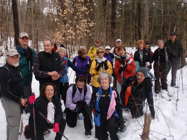
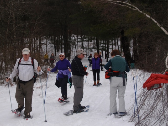
Twenty-three tramps snowshoed in the Otter Creek Horse Trails of the Independence River Forest.

A January thaw warmed temperatures to the mid-40’s, forcing lots of stops to shed clothing.

Despite the melt there was still plenty of snow and at least in the forest, snowshoes were very helpful. We followed Proceeding Trail to Frost Pocket through some peaceful pine forest.

P1010012

Payne Lake was our destination for lunch; too warm to skate, too cold to wade but very pretty nonetheless. Continuing on the loop clockwise, the trek  followed established snowmobile paths along Old Number 4 trail, so this portion of the trip went quite swiftly.

P1010025


Hike #6120 – SNOWY MOUNTAIN – January 5, 2013

Hike #6120 – SNOWY MOUNTAIN – January 5, 2013

Write-up by Meg Higgerson

On this beautiful sunny day with temperatures in the 20’s and well over a foot of snow on the ground, sixteen Tramps attempted the snowshoe of  Snowy Mountain  with its 2100 foot vertical rise.   Arriving at the trailhead around 10 am we decided that no matter where we were on the climb we would have a turnaround time of no later than 1 pm.   This would allow for adequate time to return to the vehicles before we lost sunlight as well as the any winter warmth.

The initial part of the well broken trail meandered along Beaver Brook with numerous crossings on snow covered boards or ice bridges.  Up and down we went for several miles until we began the much steeper climb.  At the point when we were over 3000 feet, it was like a winter wonderland with absolutely breathtaking views of Indian Lake and the eastern Adirondacks.   Words and pictures cannot describe the views against an azure blue sky of deep snow clinging to the trees and the deciduous trees sparkling with frost crystals.

Four of the group had reached the summit while the rest of us were within a few hundred feet.   At the appointed turnaround time of 1pm, we started our descent. A “butt slide” in the deep snow down the steep descent was the way to go.  What fun!  After the long trek out, we were back at the cars around 3:30 and happy to have spent the day with good friends in the beautiful winter wonderland of the Adirondacks.