Browsed by
Author: mconnors921

Hike # 6053 – MONTARIO POINT – June 10th, 2012

Hike # 6053 – MONTARIO POINT – June 10th, 2012

Sometimes we question whether it is worth driving 70 miles to kayak 7, but in the case of Montario Point on Lake Ontario it was well worth the trip.  Our leader took us on the winding backwaters of the protected bay. We went by beaver dams, through marshlands full of birds and ate lunch on the east side of the inlet.  The beaches on both sides of the inlet had shallow water for swimming with a deep channel dividing the two shores.  Many others kayaked to this spot from the launch and larger boats entered from the lake to troll and cast for fish.  I saw one group catch a nice size large-mouth bass.  Unfortunately it was one week shy of opening day for bass so they had to throw it back!

There was a rope swing just in from the inlet, but with the water clouded with mud & silt no

one from our group wanted to take the chance of landing on a submerged log.  We decided to take a swim, enjoy the sun and the watermelon and home baked cookies thoughtfully provided by our leader and co-leader.

It was an easy paddle on calm water.  Even Lake Ontario was on its best behavior and we could easily have paddled down the shore to our cars.  Some long-time members remembered paddling the same spot maybe 15 years back and said that the water level had changed a lot.  At one time the lake met the backwater where we launched, now there is about 150 feet of beach between the two.  They also remembered the water being much clearer. None of us were sure, but we all figured that some of the aquatic plants were probably invasive species and that is why the water was becoming choked by them.  Nature usually has checks and balances, but in the case of invasives, nature often can’t catch up with the rapid growth and propagation of these pests.

The day ended at the Rainbow Shores restaurant and motel.  Now if you have never heard of this establishment it would not surprise me as we never could have found it but for our leader having spent a lot of time in that area in her younger years.  The restaurant is a gem of a place.  It has capacity for small parties and wedding receptions, has a nice patio and outdoor seating in the back and I hear the sunsets are fantastic!  The food was tasty and though the menu offered many of the usuals their presentation was often unique.  Such as a turkey sandwich with apple slices, cheddar cheese, cranberry sauce and horseradish mayo, served with homemade chips.  As my husband often says, “It was to die for!” and big enough that we were glad we split one.  A final stop for ice cream made the day complete!

By Lu Blanchard

Hike # 6051 – ROGERS ENVIRONMENTAL CENTER – JUNE 3, 2012

Hike # 6051 – ROGERS ENVIRONMENTAL CENTER – JUNE 3, 2012

Nine tramps ignored the rainy forecast and 60-degree weather, and met at the starting point at the Waterville Post Office. As the time to leave approached, the skies opened up and we ran to our cars to start our drive down route 12 to Sherburne. By the time we arrived, the rain had let up and we were able to light up the charcoal, cook our hot dogs and hamburgers, and enjoy a picnic lunch. Although the grey skies continued, we were able to hike the trails of Rogers Environmental Center with only a minimal, intermittent drizzle. The usually abundant turtles were nowhere to be seen, although some sharp-eyed tramp did spot the head of one peeking out of the water. Beautiful purple, white, and yellow wildflowers, along with the fragrant aroma of various flowering bushes made the hike quite enjoyable. As we made our way back to the pavilion where we had left our coolers, cooking utensils, and left-overs, we saw a crow attacking a bag of taco chips that had been left on a table. It was closed, but the crow had ripped the bag and was enjoying his unexpected treat. A red squirrel was watching him closely, waiting for his chance to snatch up some of the pickings. We chased both of them off. Luckily, we had securely covered all the other goodies and were able to have a snack before we called it a day. One of our hikers, Greg Perez, completed his fifth hike and another, Donna Wester, who is also a geocacher, was able to find eight caches. It was a successful day for all.

-by Mike & Janice Huss

ADIRONDACK 46ERS – May 26th, 2012

ADIRONDACK 46ERS – May 26th, 2012

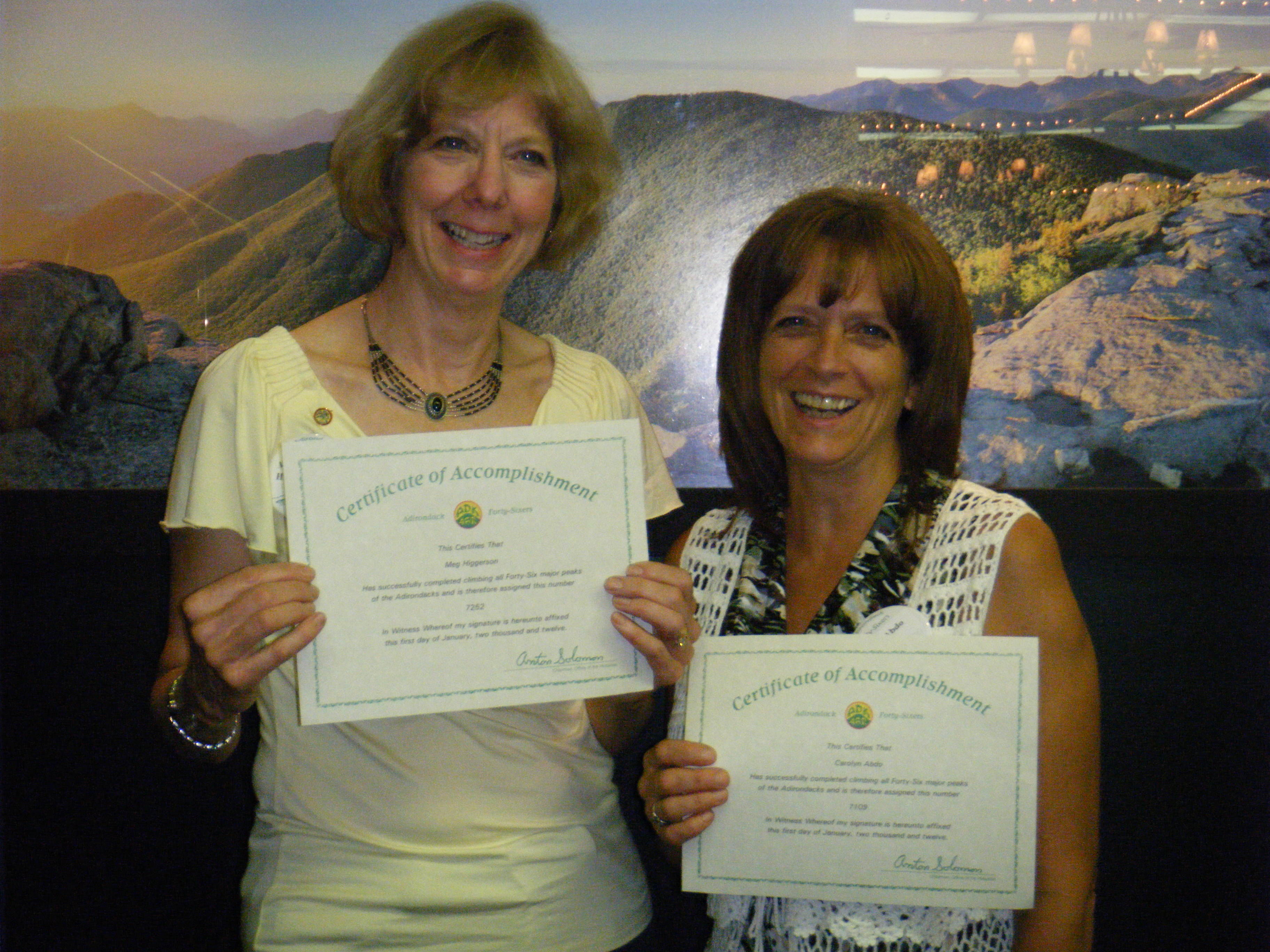
Four members recognized as new “Adirondack 46ers” at the ceremony held at the Crown Plaza in Lake Placid on May 27th, 2012.  From Left to right, they are Grace McNasser,  Meg Higgerson, Carolyn Abdo and Tom Schenck.    Grace who is 72 also received the distinction of being 2011’s most senior hiker  to have climbed all 46 high peaks of the Adirondacks

Adirondack Mountain trails are full of surprises!!  I was hiking in the remote Seward Range with two friends Grace and Roger on August 26, 2011.   On the trail since 6 am, it was 4 pm and we had not run into another human being when suddenly over the ridge we saw 3 hikers approaching.   We stop to chat with Carolyn, Tom and Dian and to  exchange hiking experiences as well as our starting point.   Carolyn said she was from a small town we most likely had never heard of…DEANSBORO!      What a shock since I am from Deansboro also and it turns out that though we had not previously met, Carolyn Eastman Abdo’s relatives live next door to me!!!

Carolyn and I have hiked together since our surprise encounter on Seward Mountain.   Even stranger, we learned that at one point in our lives we both were residents of an even smaller town…Gray, NY.

Below is a picture of Carolyn and I at the May 27th recognition ceremony in Lake Placid for those who have completed hiking the 46 highest peaks in NYS.

By Meg Higgerson

Hike #6047 – HUDSON RIVER SCHOOL ART TRAIL – May 26th, 2012

Hike #6047 – HUDSON RIVER SCHOOL ART TRAIL – May 26th, 2012

We carpooled down the Thruway to exit 21, regrouping at Cedar Grove, the home and studio of Thomas Cole, founder of the Hudson River School of Painting.  From there we proceeded over the Catskill Creek and through the Kaaterskill Clove up to the Kaaterskill Falls.

The trail starts with the beautiful Bastion Falls and proceeds upwards one half mile to Kaaterskill Falls, the highest falls in New York State , as if climbing a natural staircase. It was nice to see so many young people and families out in nature.

Next we stopped at  North-South Lake State Park.  We parked in the South Lake Parking Lot and walked along both lakes through the woods to the shores of North Lake where we had lunch.  From there we took the trail up to Artist’s and Sunset Rocks.  The shaded forest felt cool as we  climbed steadily to our destinations.  The views of the Hudson River, the twin lakes, the farms in the valley, the mountains in the distance were wonderful in spite of slightly hazy skies.  When we checked out this hike a month before, the mountain was encased in fog and we saw nothing but white mist.  On our way back to the cars, we took a short side trip to the site of the Catskill Mountain House for more spectacular views.  The Catskills differ from the Adirondacks in several respects but the most important on this day was NO BLACK FLIES!!!!!!!!!

By:  Nancy Coleman

Hike #6045 – GULL LAKE – May 19, 2012

Hike #6045 – GULL LAKE – May 19, 2012

Gull Lake is one of our favorite hikes.  Given the time of year we worried about black flies, and they were out and biting, but not as bad as we sometimes have experienced.

The weather was almost perfect, but a little warm if you were wearing a full bug shirt.  Most of the spring flowers have ceased blooming but we did see a number of painted trilliums.

The hike proceeds in a clockwise direction beginning at the Bear Creek parking lot and extending for a short distance along a truck road before bearing left onto the lower foot trail.  There are still a few blowdowns on this trail although they are not nearly as bad as in past years.  The puddles, however were extensive, wide, deep and muddy and required quite a few detours.  The trail turns right after a little over a mile and begins a steep ascent.  This part of the trail is deeply eroded making footing a bit difficult, and we encounterd even more water as we neared the top and the lake came into view.  Turning left we took the trail to the lean-to.  The sign said 0.4 miles but the many ups and downs made the distance seem much longer.   Soon we saw the lake on both sides of the trail, indicating that we were on the point where the lean-to is situated.  This is an ideal spot because a fresh breeze eliminated any black flies.  We quickly kindled a fire and began the roasting of hot dogs.  As usual, two loons and a pair of seagulls occupied the lake and we rejoiced in the music of the loons.  Several people waded in the shallow water off the point while others just relaxed and enjoyed the beauty of the place.  Deb Robert’s little grandaughter, Chloe, was overjoyed to find that someone had suspended a rope and log from a tree and spent most of her time swinging back and forth.  Reluctantly we extinguished the fire and turned homeward.

We backtracked until we reached the trail to the Chub Pond intersection.  This trail follows an old tote road for most of the way narrowing to a foot path only a short distance from the intersection.  Here there were even more puddles to circumvent but fortunately the water at the first crossing of Gull Lake Outlet had receded and we were able to cross on a bridge that had been submerged when we made the trip in 2009.  The remains of the crude bridge we had constructed and crossed on were still there.

The Chub Pond trail had a few wide puddles near the intersection but then became an easy, mostly downhill jaunt to the parking lot where ice cold watermelon awaited hikers who were hot and thirsty after an 8 mile hike.

By:  Harold Pier

Hike #6036 – FLOYD TOWN PARK – April 15, 2012

Hike #6036 – FLOYD TOWN PARK – April 15, 2012

It was an overcast day in the 60’s when 12 of us arrived at the Floyd Town Park. We quickly realized that we had a major problem; Carol Dippolito could not find her sneakers. She forgot to put them in the car. Luckily, she spotted an extra pair in the back of Bill Wilson’s car. Carol asked Bill if she could borrow them and he said they would be a little big, but go ahead and try them. They worked fine. The first three miles were quite comfortable and even the last mile, with a light drizzle falling, was refreshing. After the hike, we were off to the Okey Dokey Restaurant for sandwiches and beverages.

-by Mike and Janice Huss

Hike #6032 – NINE CORNER LAKE – March 31, 2012

Hike #6032 – NINE CORNER LAKE – March 31, 2012

In a normal spring this would have been a late snowshoe, but even though  light snow dusted the ground and continued to fall fitfully during the day 29 Tramps had decent walking with the usual detours around beloved Adirondack mud.  We shuttled cars to the trailhead near the intersection of Routes 29-A and 10 and then began our hike where Snowmobile route 8 heads north toward Fourth Lake from Rt. 29-A.

The trail provides nice views of Burnt Vly and reaches an intersection after 1.1 miles of easy walking.  Here Snowmobile Rt. 82 branches off to the right toward Nine Corner Lake and proceeds gently upward between high hills on either side.  The  open forest is mostly mature maple ash and beech. Nine Corner Lake is a popular haunt of rock climbers  and soon we began to see large, erratic rocks..  After about one mile we skirted around a large beaver meadow and began the last climb to the lake.  A primitive campsite provided ample dry firewood and a sheltered spot for lunch.  After our three- mile climb to the lake the one-mile descent to Rt. 29-A and the cars seemed easy.  After this many of us retired to Arthur’s in Dolgeville for a light repast.

By:  Harold Pier

Hike #6029 – LAKE DELTA STATE PARK – March 18th, 2012

Hike #6029 – LAKE DELTA STATE PARK – March 18th, 2012

On a dazzling sun-shiny, blue-sky day, Jean Yost, Leader, and Kathy Countryman, Co-leader,  led a group of 34 Tramps on a 4 mile hike around the inside perimeter of  the lake.  There were two individuals making their first hike with the Club.

It was an unusually warm 78 degrees for March 18th encouraging a few to zip off the bottom half of their hiking pants.   Early arrivers were interested in seeing a Baltimore Oriole’s nest that Bess Bessey had found and brought to share with the group.

As we walked among the barren trees through the woods and heard some happy songbirds, one could almost see the ice melting away on the lake as the ducks hung onto the remaining edge.   After returning to the beach at the end of the hike,  the group relaxed at picnic tables enjoying conversation and cookies!

By:  Jean Yost

Hike #6028 – LEPRECHAUN HUNT PIXLEY FALLS – March 17, 2012

Hike #6028 – LEPRECHAUN HUNT PIXLEY FALLS – March 17, 2012

What was to be a Ski or Snowshoe ended up being a hike due to our warm 60 degree temperatures.

Twenty two adventurers walked the 5 mile Black River Canal Towpath avoiding some slippery and muddy spots along the trail.

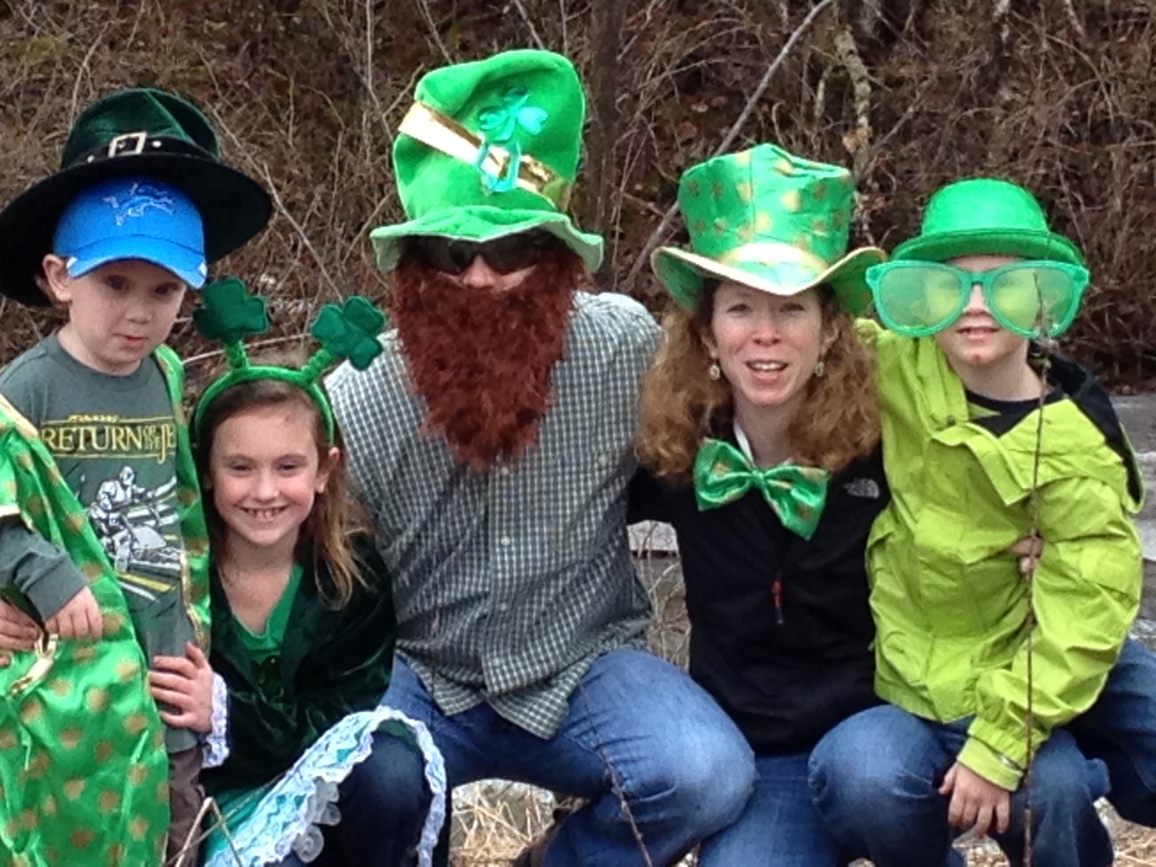
With Saint Patrick’s Day spirit, we found gold candy and coins along the way and suddenly were accosted by a Leprechaun family of five. They joined us for spectacular views of the numerous waterfalls and enjoyed jumping out at us as we crossed the bridge to the picnic area.

We all departed with a smile on our face after eating shamrock cookies.

By Meg Higgerson

Hike # 6022 – CAZENOVIA PRESERVATION FOUNDATION, FEBRUARY 25, 2012

Hike # 6022 – CAZENOVIA PRESERVATION FOUNDATION, FEBRUARY 25, 2012

The hardest part of this hike was getting to Cazenovia from the Madison Central School meeting place. It was a rough trip up and down the hills of route 20 on very icy and snow-blown pavement. In spite of the road conditions, nine of us made it to the trail-head. It was white-knuckle driving all the way. After getting into the woods, we were protected from the wind and were able to enjoy the hike to the Lorenzo Museum. We did not need snow-shoes because the snow covering the trail was not very deep. We tried to eat lunch in the gardens at Lorenzo but the wind coming off Cazenovia Lake was so strong it pushed us back into the woods for protection. We were able to find a picnic table along the trail where it was more comfortable to enjoy our lunch. Hiking back to the parking area wasn’t a problem until we came to an open field. The winds were fierce, but everyone made it. Because of the poor road conditions, we decided that it was best to head directly home instead of stopping at the Tavern for a beverage.

by Mike & Janice Huss