Browsed by
Author: mconnors921

Hike #6296 Essex Chain of Lakes – July 12, 2014

Hike #6296 Essex Chain of Lakes – July 12, 2014

Write-ups by Meg Higgerson, Bill Higgerson, Grace McNassar
Leader of Essex Chain: Meg Higgerson
Co-Leader: Sue Bell
Leader of Goodnow Flow: Bill Higgerson

The Essex Chain of Lakes was recently opened to the public. Until late last fall it was posted as leased land of the Gooley Club. When we checked out the paddle at the end of June it became clear that not all Tramps might be interested due to the 2 mile portage and the potential damage to one’s kayak. As a result, an easier option was offered…a paddle on Goodnow Flow, a private lake.

Here are 2 hike reports for #6296:
At 9 am, 11 Essex Chain Paddlers met at the Higgerson’s camp on Goodnow Flow, moved kayaks to high clearance vehicles and prepared to travel the 6 miles to the trailhead. Once there we strapped on wheels and portaged 1/4 mile to Deer Pond, someone always having to “work the kinks out” with the wheels.

Essex Chain Kayak - 39

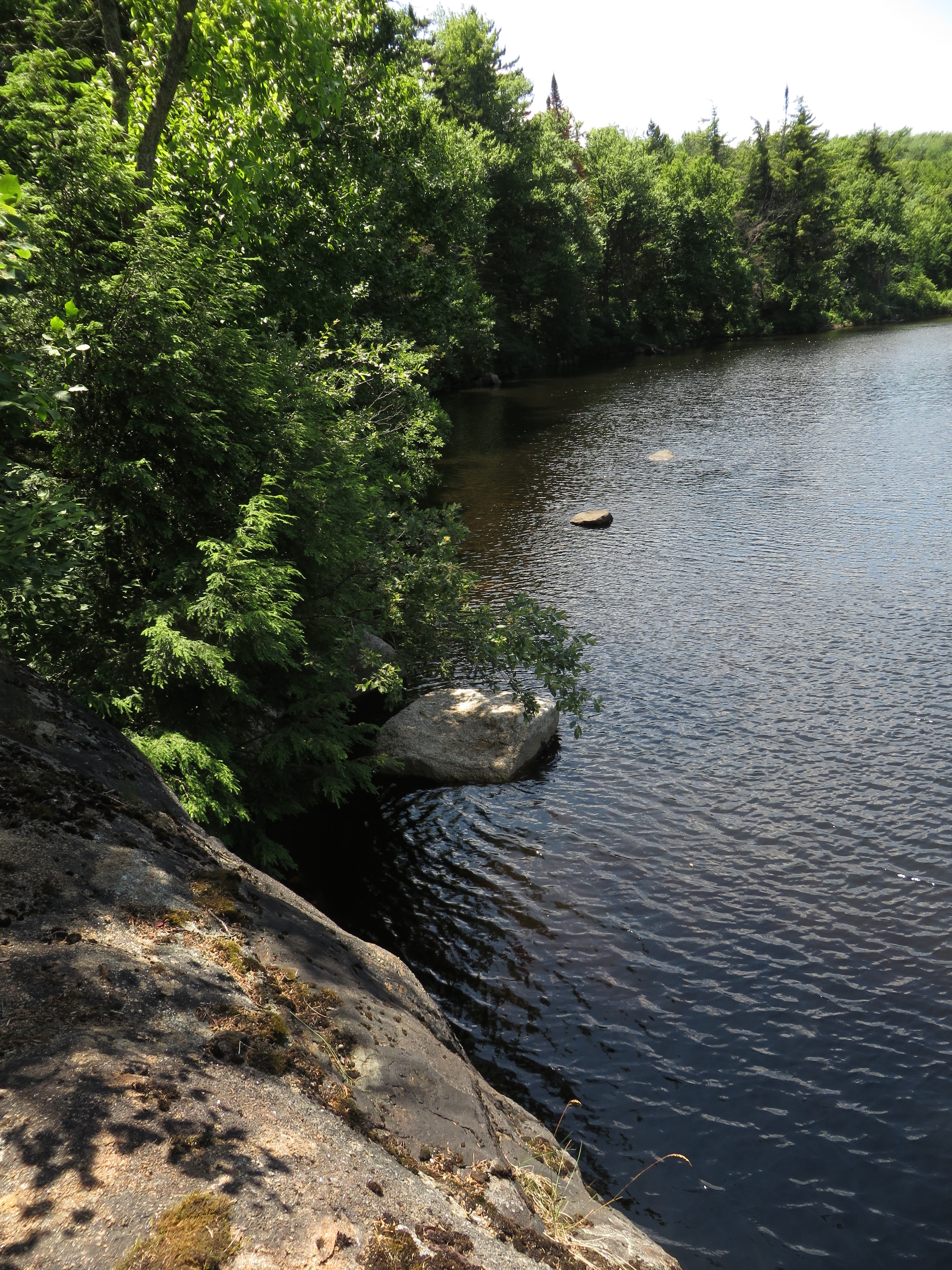
We got a taste of what the Essex chain had in store as we paddled down pristine Deer Pond where we found some very unique erosion-caused rock formations.

Essex Chain Kayak - 33

The next portage was tough as we pulled the kayaks up a hill over roots, rocks and ridges to the dirt road. Once again on the road the portage was easier but we were soon back in the woods on our way to 3rd lake.
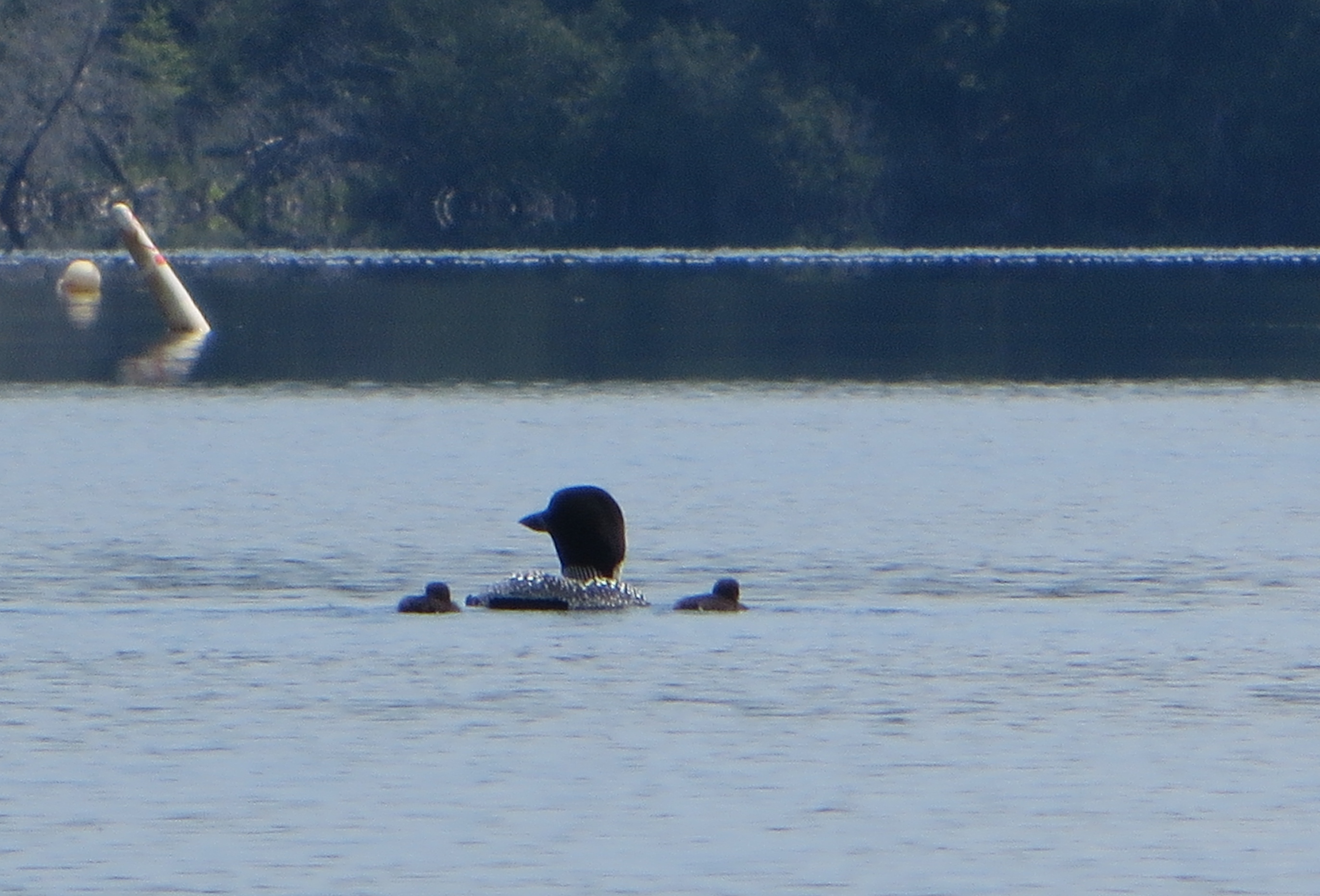
We stashed the wheels and began our paddle. It is hard to describe the beauty of the lake but as we paddled we saw several loons with their chicks, listened to and watched for birds, saw one or two other paddlers in the distance, caught a glimpse of the Gooley Club compound and enjoyed the adventure as we looked for the inlet to 4th lake.

IMG_0731


Essex Chain Kayak - 24

Paddling through lilies of all sorts we entered 4th lake and looked for a lunch place.

Essex Chain Kayak - 19

What a surprise to find a perfect spot with a picnic table!! Next we headed to 5th lake where we had to pull ourselves with an overhead rope through a culvert that ran between 4th and 5th.

IMG_0746

Across 5th, we entered a long narrow channel full of more lilies, purple pickerel weed and floating bogs with frogs, before we arrived at 6th lake.

After spending a while on 6th lake, we paddled into the wind all the way back through 5th, 4th and 3rd. In spite of that, we made quick progress always having the upcoming 1 mile portage on our minds. Again the wheels took their toll and there was much discussion as to how to attach them, where to locate them, whether to get new wheels or maybe a new kayak or better yet to work out more!!!

IMG_0718

Most of us avoided Deer Pond on the return trip and portaged the boats on the road which went around it. Loading the kayaks we bounced on back to the Higgersons camp and arrived at 4 pm anxious for a cold drink or a dip in the Goodnow Flow. Meg

IMG_0755

The Goodnow Flow Paddle start time was 10 am and 9 paddlers participated. Prior to the paddle, Bill gave a history of the Goodnow Flow and an overview of the upcoming paddle. The lake is 3+ miles long and is fed by the north and west branches of the Goodnow River. They paddled to the inlet of the North branch and proceeded to the mouth of the channel for the west branch. They continued up that channel to Shadow Dam. They spotted a baby mink swimming to the bank. Then they were on to Blueberry Island where they enjoyed lunch on the sandy beach. It was a leisurely paddle arriving back at the Higgerson’s camp around 2:30. Bill

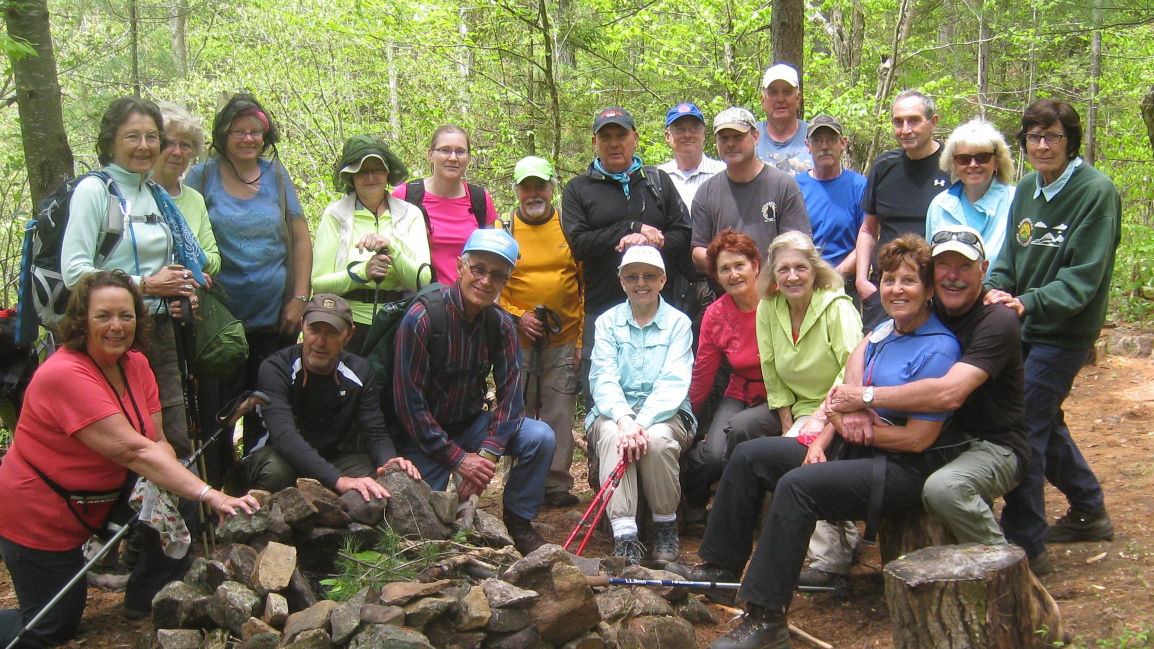
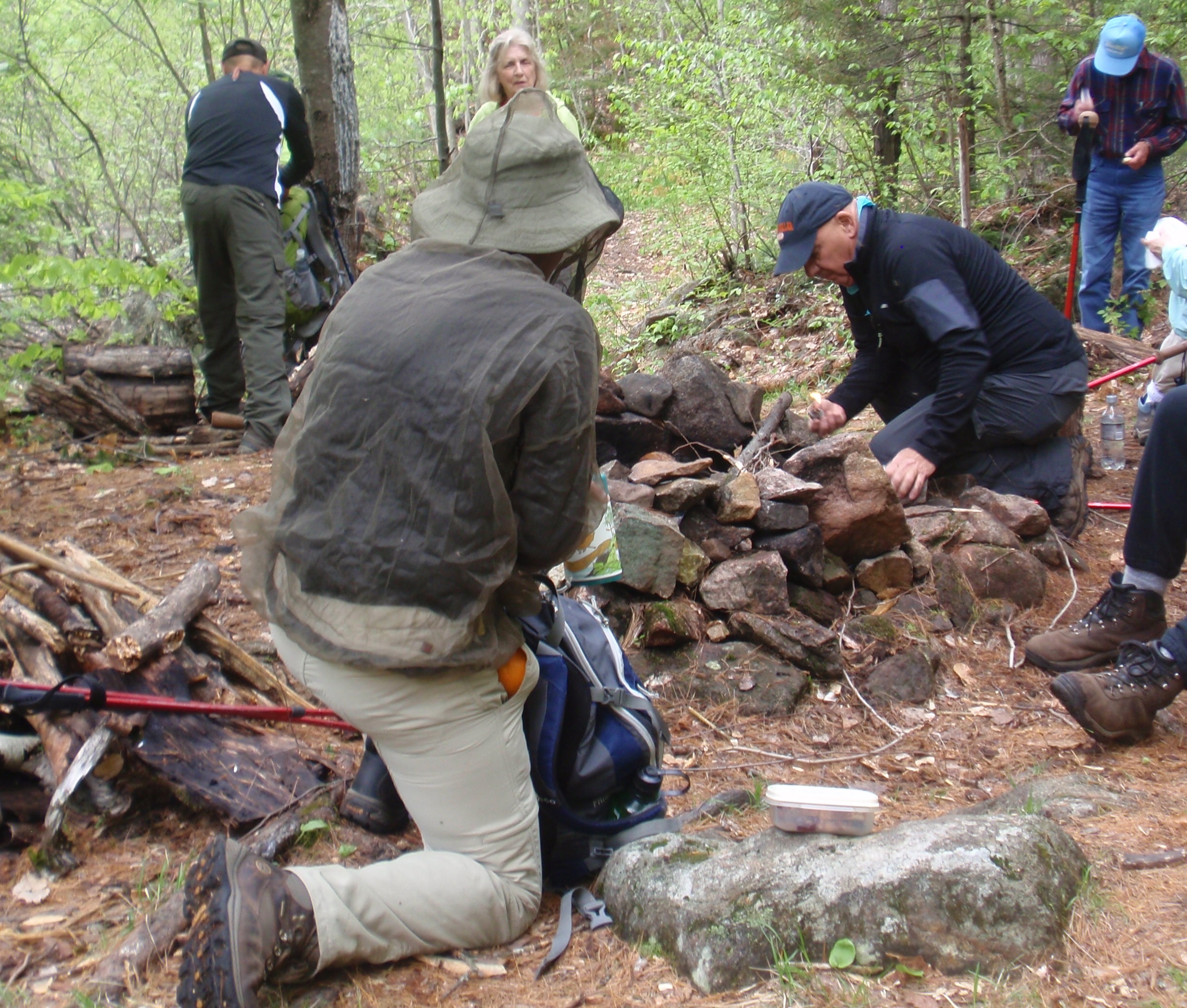
At 6 pm 28 tramps enjoyed a cookout and “pot luck” hosted by the Higgersons and Grace McNasser. Grace was invaluable in getting things organized while the paddlers were paddling and the 5 hikers were hiking Goodnow Mountain. This was the eighth year that the Tramps have come to our camp in Newcomb and feedback was that they hope to be back again next year!! We look forward to it!! Meg, Bill and Grace

Hike #6294 GO FOR THE GOOLEY’S July 5, 2014

Hike #6294 GO FOR THE GOOLEY’S July 5, 2014

Write-up by Meg Higgerson

Leader: Meg Higgerson
C0-Leader: Barb Thomas

It was a bright sunny day when 18 Tramps set out for a lovely hike to the Cedar River. We would visit  the 17,320 acre Chain Lakes Tract, a very recent acquisition of New York State. We consolidated cars in busy Indian Lake and found just enough parking at the Outer Gooley Club trailhead which once was the original farmhouse of Olive and Mike Gooley. What a lovely setting on the confluence of the Indian and Hudson Rivers!
The Gooleys - 13
We have hopes that this interesting landmark will be placed on the State and National Register of Historic Places.  After passing through the gate and signing in we walked the dirt road looking for moose tracks. We did spy some but they unfortunately were several days old. Reaching the Cedar River in a little over an hour, we had lunch; some of us on a bedrock outcrop overlooking the motionless river which reflected the surrounding mountains and others in a cool and shaded wooded area.

IMG_0687 copy

On the return trip many took a side trip to Clear Pond. The DEC sign indicated .3 miles but we soon realized that it was closer to .6mi. We descended a hill to find vistas of this beautiful wilderness lake with a not to be forgotten perfect picnic spot.

IMG_6104

IMG_6109

We then took time to explore the Gooley Steps on the Hudson.

IMG_6123

Along the way there were many questions and  discussions about the Gooley Club and Olive Gooley.

Here is a web site on Olive : http://www.adirondackhistory.org/newguidesl/olive.html and an article from 2007 which describes the concerns of hunting clubs.   http://www.adirondackexplorer.org/stories/gooley-clubs-last-stand.

It is our fortune that NYS did open the lands to the public and that we had this opportunity to enjoy them.


Hike #6290 LAKE MORAINE June 22, 2014

Hike #6290 LAKE MORAINE June 22, 2014

OLYMPUS DIGITAL CAMERAWrite-up by Kathy Countryman

Twenty participants enjoyed a leisurely paddle around Lake Moraine on a delightful Sunday afternoon. Sunshine and a mild breeze made for a very pleasant trip. Eleven of us extended the day a bit by crossing the road to paddle the water on the other side. It’s much quieter there, with almost no camps, but paddling is slower due to the large amount of vegetation in the water. The water lilies were in bloom, and some large fish jumped around us as we wended our way along.

There were no mishaps along the way, for which the first-time leader was grateful!

OLYMPUS DIGITAL CAMERA

Hike #6288 WEST LAKE TO STEWART’S LANDING June 15, 2014

Hike #6288 WEST LAKE TO STEWART’S LANDING June 15, 2014

Write-up by Nancy Coleman

The weather forecast was not too good and it was Father’s Day, but seven Tramps came out and kayaked from West Lake to Stewart’s Landing. As usual the weather forecast was wrong and we had a wonderful day to paddle. The water level was quite high so going down stream was not hard. Many people were out on their docks and someone told us that we’d have a really hard time paddling back. Fortunately the wind was blowing on our backs and it was easier than the trip down stream.

We saw a loon sitting on her nest. Later a great blue heron flew by.

Crossing West Lake to return to the put-in was windy and choppy. Some of us got splashed by the waves. That section can be challenging.

Bill Warren had a GPS and informed us when we had gone 8 miles. We had a way to go. The distance is actually 9.7 miles, so we all got a bit of extra exercise that day.

#Hike #6287 MOON IN JUNE IN BOONVILLE June 14, 2014

#Hike #6287 MOON IN JUNE IN BOONVILLE June 14, 2014

Moonlight hike in Boonville - 05

Write-up by: Lu Blanchard

Despite the cloud cover the “Moon in June” hike really shone. We ate dinner at the Boonville Hotel – Rebecca had a chance to see us clean and shiny instead of sweaty and dirty! Food was great as always and stories were told and retold as we sat around the table. While waiting for the rest to arrive from Mapledale, the diners took a pre-hike around Erwin Park and visited a Civil War Veteran’s grave in the cemetery across the road. This Union soldier died of exposure at Andersonville Prison, one of the most horrible POW camps of the war. It is a wonder his body was recovered. We had a chance to relive our childhood on the playground equipment – the slide proved too much for a couple of us and the merry-go-round went around a few too many times for others! By then the rest of our group (19 in all) arrived and we started out on the canal trail.

Moonlight hike in Boonville - 04

No moon was visible, but ambient light defined the trail with little problem. On occasion, the dense tree canopy left us truly in the dark, but the path was wide and easy to follow. We were entertained by flickering fireflies along the way and a balmy breeze helped keep us cool. The weathermen led us to believe temperatures would fall into the 40’s, but that didn’t happen until well after we were home, asleep in our beds. Gail brought ready to eat (pre-cut) watermelon that was gobbled up by us all. It was so cold and sweet it really hit the spot!

After all was done, I think we would agree that the all-night hikes with breakfast cooking in the morning will have to be left for the next generation of tramps! Bed never felt so nice! Thanks to the Boonville Town Board for allowing us to use the facilities after hours and thanks to the co-leaders, Gail & Bobby, for being such sports!

Moonlight hike in Boonville - 01

#6284 – Berkshire Adventure – June 3 – June 5, 2014

#6284 – Berkshire Adventure – June 3 – June 5, 2014

Write-up: Bobbie Scarpino
Leaders: Bobbie Scarpino, Paul Fortin

The weather forecast called for gloomy, rainy skies as 20 tramps started out to drive the 140 miles to North Adams, MA for a three-day midweek, multi-activity adventure. But when we arrived at the Holiday Inn on Tuesday, June 3, we were greeted instead with sunshine and temperatures in the 80’s. After checking in and changing into biking clothes, all drove the few miles to the Adams Visitor Center to begin our first adventure of biking on the paved Ashuwillticook Rail Trail – Round trip 22 miles.
The scenery was beautiful. In some sections the trees formed a canopy tunnel for us to pass through. Mt. Greylock and other mountains in the Appalachian chain flanked one side. The Hoosic River bubbled and flowed along the trail for a while. Another section of trail ran close to the edge of the Cheshire Reservoir.
At the farthest end of the trail in Lanesboro, a cell phone was checked for a weather update. A severe thunderstorm was heading our way and would be upon us soon. Our bikes grew wings as we flew back the 11 miles to the cars. The sky became so dark that it became difficult to see the trail in the canopied area. We were hoping that Dick Blanchard would come to our rescue with his headlamps to light the way! As bikes were loaded onto the cars, the first raindrops fell. Everyone quickly headed to CJ’s Sports Bar located alongside the Ashuwillticook Trail to wait out the worst of the storm while enjoying a cold beverage.

Scan 142370008-2

Scan 142370008-3

The next day, June 4, dawned with a wet ground and low clouds covering the tops of the mountains . . . but no rain! Our adventure this day was to hike Mt. Greylock, highest point in Massachusetts, on the Appalachian Trail. After meeting in the hotel lobby to plan our route, ten tramps decided to hike to the summit of the mountain along the Hopper Trail (or as Paul called it, “Hawpa”), total distance 5.4 mi. Four adventurous Tramps decided on a route out of the ordinary, beginning at the summit and hiking down and then hiking back up. This hike was done as a loop to Jone’s Nose and had a total distance of 8 mi. Six Tramps believed that this would be the best opportunity to kayak the Cheshire Reservoir, since Thursday’s forecast called for rain all day. As all of us started out on our different adventures, the sun broke through the clouds, making it a perfect day enjoyed by all.

IMG_4901 IMG_4150.1

IMG_4921

Scan 142370008

Hike #6283 – OHIO BIKE/HIKE – June 1, 2014

Hike #6283 – OHIO BIKE/HIKE – June 1, 2014

Write-up by Carol Dippolito

We had 22 hikers, bikers out today.  The weather was perfect and the black flies stayed away.  Mike and Janice Huss led the hike which totaled 4.7 miles, Chuck Balser led the 18 mile bike and Carol Dippolito led the 8 mile bike.  Everyone commented that they enjoyed what they did.  We ended up at the Ohio Tavern for a delicious meal.


Hike #6279 – GLEASMAN FALLS – May 24, 2014

Hike #6279 – GLEASMAN FALLS – May 24, 2014

Gleasman Falls from JIm - 5

Write-up by Barb Thomas.

The remote falls are located on the Independence River near the Otter Creek Horse Trails. We had a beautiful day for this remote hike. It was necessary to drive on Beach Mill Rd. for about two miles to reach the parking area. As we started up Beach Mill Rd., we could see a small buggy with a horse and driver. We followed her, as with the narrow road there was not room to pass. When she arrived at a place she could pull over, there was an elderly lady driving the small white horse. We talked with her for several minutes and it was a pleasure to have this conversation. She apologized for being so slow on the hill. We assured her that we enjoyed following her horse and buggy up the hill. She explained she was driving the dirt road down to Cleveland Lake and planned to do a loop.
She said her horse was 20 years old and slow on the hills. (The horse is not the only one that moves slowly up the hills.) As we were leaving her, she said it was a delight to talk with us and we were very kind. We left her with a good impression of the Tramp and Trail Club. It was indeed a pleasure to meet with her.

We continued on the dirt road to the end and parking area. Everyone prepared for the hike and we were off. We crossed Burnt Creek on a large wooden bridge. The trail is well marked and not difficult. We did have a couple wet areas due to recent rain but it truly is an enjoyable trail to hike. As we proceeded, we passed an old large pond area with fallen trees and old beaver house. We continued on this well-maintained trail but it does have hills.

As we hiked along the trail we could hear the waterfalls in the distance. We crossed another stream over a small creek and climb up a hill and came to the informal campsite. Roger built a fire and this helped to keep the bugs away from us.

OLYMPUS DIGITAL CAMERA

After lunch, we made our way up the path along the falls, stopping to get great views of the rushing water through narrow ledges and over rocks. We reached the top of the falls and as you looked up stream the water was calm and flat—what a difference!
Of course, there was picture taking along the falls. We turned around at the top and returned to the informal campsite. We gathered up our packs and made our way back along this interesting trail. There were a variety of wildflowers near the trail. This area is a great place to visit and the hike is only six miles in total.

OLYMPUS DIGITAL CAMERA

OLYMPUS DIGITAL CAMERA

It was back to the parking area and the Tramps prepared to move slowly down the dirt road and back to Erie Canal Road. We continued back to the Boonville Hotel for some cold refreshments. It truly was a beautiful day and we visited an area that many Tramps had never seen. It was enjoyable to sit outside at the Boonville Hotel and enjoy conversation and exchange memories.


Hike #6269 – SLEEPING BEAUTY MOUNTAIN LOOP – April 13, 2014

Hike #6269 – SLEEPING BEAUTY MOUNTAIN LOOP – April 13, 2014

IMG_0223

Write-Up by: Nancy Coleman

Eight hearty Tramps started out very early after attending the Annual Dinner Meeting the night before. The weather at best was iffy. The pre-hike on Wednesday was in snow and water even at this late date in the year. Since then the weather has been in the 60’s meaning much of the snow would be melted and I was hoping that the water had run off. The hike description said, “in the Spring with the snow melt, the trail turns into a river.” Oh dear.
The weather was good to us. It is a beautiful trail to hike and unlike most Adirondack trails there are switchbacks. Everything was fine until we got past the switchbacks on the steepest section. On Wednesday we were hiking through packed snow. Today the snow had melted. All that was left was slippery, glare ice with water flowing over it. We all got to the overlook without incident.
We enjoyed a windblown lunch on the top (not the true summit) with a wonderful view of the Green Mountains of Vermont and the high peaks of the Adirondacks with ice covered Lake George just below us. Now we had to plan our trip back.
On Wednesday we were not able to take the back of the loop because of deep snow and no snow shoes. Upon checking the trail we could see that hikers had walked there today. We started out on unexplored territory believing it could be no worse than what we had seen.
It was for sure the correct decision. We crossed through a small stream. Saw Bump Pond and a beautiful waterfall flowing through a huge chunk of pristine, blue ice. Much of the trail was the river described in the write-up, but as true Tramps we all had a great day.

IMG_0233

Hike #6265 – PENN MOUNTAIN – March 30, 2014

Hike #6265 – PENN MOUNTAIN – March 30, 2014

 There once was a chap named Dick,

Whose wife Lewellyne was sick,

In all of his dreams,

the women it seems

Surrounded his body with Tramps

Jim W.

IMG_5708

A gregarious gent named James

took record of outings on frames

His camera did click

and recorded a Dick

surrounded by several dames.

Lu B.